
Every city you’ve ever lived in runs on systems you probably haven’t thought about since… well, ever. Water mains, sewage lines, power grids, storm drains, and the actual ground holding everything up. When they work, nobody notices. When they fail, everyone notices at once.
Most cities get by fine. The pipes are old but functional, the grid holds through summer, the foundations do what foundations do. But some cities are aging badly, and they’re stacking up problems that compound on each other, where one bad storm or one dry summer or one seismic jolt turns a manageable situation into something that cascades out of control.
There’s a massive city sinking into the lakebed it was built on, dropping inches every year while the aquifer beneath it drains away. There’s one that nearly had to shut off the taps for four million people because the reservoirs were almost empty. And there’s one built along a fault that seismologists have been warning about for decades, where vast numbers of people go about their lives knowing the ground could move without much warning.
Key Takeaways
- Mexico City sinks up to 20 inches yearly as aquifer pumping irreversibly compresses clay beneath 22 million residents, with 40% of water lost to pipe ruptures.
- Indonesia is relocating its capital from Jakarta to Borneo because 40% of the city now sits below sea level, with northern districts dropping 4-5 inches annually.
- Istanbul faces a roughly 70% chance of a magnitude 7+ earthquake within 25 years, with 600,000 buildings at risk of immediate collapse and three million people potentially displaced.
- Cape Town narrowly avoided ‘Day Zero’ in 2018 through extreme conservation alone, but has built no major new water infrastructure since, leaving the same vulnerable system in place.
- Miami’s porous limestone geology renders traditional flood walls useless, allowing seawater to bubble up through the ground itself and contaminate the Biscayne Aquifer.
These cities are real places, full of real people, running on borrowed time.
Mexico City — Sinking Into Itself
Most people understand that building a city on a drained lakebed isn’t ideal. Soft ground, unstable foundations, the kind of thing engineers have been solving for centuries. We’ve built skyscrapers on sand, tunneled under rivers, suspended bridges across impossible gaps. So when you hear that Mexico City sits where a lake once was, your first instinct is probably… okay, that’s tricky, but surely they’ve figured it out by now.
More than 22 million people live there. It’s one of the largest metro areas on the planet. They must have it under control.
They don’t.
Mexico City is sinking. And not in some slow, manageable, we’ll-deal-with-it-next-century kind of way. In the worst-affected areas, the ground drops by up to 50 centimeters a year. That’s roughly 20 inches every single year.
No other major city on Earth is subsiding that fast. The whole thing traces back to a decision made about 500 years ago, when Spanish conquistadors looked at Lake Texcoco and decided they’d rather have land. They drained it. Over the course of the 16th and 17th centuries, the lake disappeared and a city rose in its place, built on top of thick layers of soft, waterlogged clay.
For a while, that clay just sat there, doing what clay does. But Mexico City grew, and growing cities need water. Today about 70 percent of the city’s water supply comes from underground aquifers, pulled up through wells drilled deep into the earth beneath the old lakebed. When you pump water out of clay, the clay compresses.
It’s like squeezing a sponge… except this sponge doesn’t bounce back. The compression is irreversible. The ground above it drops, and it stays dropped, and it keeps dropping as long as the pumping continues.
So you’ve got a city of 22 million sitting on ground that’s collapsing under them in slow motion. The effects show up everywhere once you know what to look for. The Palacio de Bellas Artes, this gorgeous marble performance hall built in the early 1900s, has sunk roughly 15 feet since it was constructed. You can see it when you visit… the street level has risen around it, and the building looks like it’s slowly being swallowed.
The metro system is warping because different stations are sinking at different rates. Tracks that were level when they were laid now tilt and buckle. Sewer lines crack. Subway tunnels shift.
Water pipes rupture constantly beneath the streets, and something like 40 percent of the water moving through city pipes never reaches a tap. It just leaks out through fractures in a pipe network that’s being slowly pulled apart by the ground moving underneath it.
A city that’s desperate for water is losing nearly half of it to leaks caused by the very process of extracting water. And the infrastructure damage compounds the problem in ways that are difficult to solve. You can’t just replace the pipes, because the ground they sit in is still moving. You’d be laying new pipe into a foundation that’s actively deforming. Same with the metro, same with the sewers. Every repair is temporary because the underlying cause hasn’t stopped.
And it won’t stop. Mexico City can’t simply pump less water without finding 22 million people an alternative supply, and there isn’t one ready. There are plans to pipe water in from distant rivers, but those projects would take decades and cost billions, and the politics around water rights in a country where other regions are also running short are… complicated. Meanwhile, every day the pumps keep running, the clay keeps compressing, and the city keeps dropping.
The real nightmare scenario is what some researchers call “Day Zero.” That’s the projected date when the aquifers could be so depleted that the wells simply stop producing enough water to supply the city. It’s not a fixed date because it depends on rainfall, conservation efforts, and how aggressively the city draws from its reserves. But it’s out there as a possibility, and the window keeps narrowing.
Mexico City is sinking because of its water extraction, and it’s also running out of the water it’s extracting. It’s a feedback loop, and nobody has found the off switch.
Mexico City isn’t going to vanish overnight. There’s no single earthquake or flood that collapses it all at once. The disaster here is slower than that, and in some ways worse. Because a sudden catastrophe gets international attention, emergency funding, a rebuild plan.
A city that sinks a few inches every month just keeps sinking. The damage accumulates. The infrastructure degrades. The water gets scarcer.
And 22 million people keep waking up every morning in a metropolis that’s gradually, irreversibly, consuming itself from below.
Jakarta — The City They’re Abandoning
When a capital city runs into trouble, governments throw everything they’ve got at saving it. They build flood barriers, reinforce infrastructure, pour billions into keeping the seat of power exactly where it is. That’s what countries do. London has the Thames Barrier. The Netherlands has been fighting the sea for centuries. New Orleans got $14 billion in upgraded levees after Katrina. You protect your capital because it’s your capital… it’s the center of everything.
Indonesia looked at Jakarta and decided to leave.
In 2019, President Joko Widodo, known as Jokowi, announced that Indonesia would move its capital to a completely new city carved out of the jungle on the island of Borneo. The project is called Nusantara, it carries a price tag of roughly $32 billion, and construction is already underway. A country of 270 million people is relocating the center of its government because the old one is, in the most literal sense, disappearing into the ground.
Jakarta is sinking. And when I say sinking, I don’t mean the slow, geological kind of sinking that most coastal cities deal with. Northern districts in Jakarta are dropping by as much as 10 to 12 centimeters per year, according to satellite measurements. That’s roughly four to five inches annually, and some localized areas may be sinking even faster. Around 40% of the city now sits below sea level, and that number gets worse every single year.
The cause is straightforward. Jakarta is home to more than ten million people, with the greater metropolitan area, known as Jabodetabek, pushing past 30 million. That’s one of the largest urban populations on Earth, and only about 40% of residents are served by the city’s piped water system. So what do the rest do?
They dig wells. Millions of private wells pull water from underground aquifers, and as those aquifers drain, the ground above them compresses and drops. Jakarta is sinking from below while the Java Sea pushes in from the north.
In the coastal neighborhood of Muara Angke, residents will tell you that flooding doesn’t come monthly or even weekly. It comes daily. The tide rolls in and the streets fill up, and then it recedes, and then it happens again. People have raised their floors so many times that doorways have become tunnels. First floors have become basements. There are mosques where you walk down to enter what used to be the ground level.
Indonesia did try other solutions before going this route. There was a proposal for a Giant Sea Wall, sometimes called the Great Garuda after the mythical bird, that would’ve enclosed Jakarta Bay with a massive barrier and created a retention lake to manage flooding. The estimated cost was around $40 billion, and the project stalled almost immediately. Partly because of the expense, partly because of the engineering complexity, and partly because even if you build the wall, the city is still sinking.
You’d be protecting a bowl that keeps getting deeper.
So Jokowi made the call. Nusantara is being built on the eastern coast of Borneo, in an area that’s largely undeveloped jungle. The idea is that government functions will gradually transfer there, relieving pressure on Jakarta and giving Indonesia a capital that isn’t sinking into the sea. Construction crews have been clearing land and laying foundations since 2022, though the project has faced its own set of problems… funding shortfalls, slow private investment, and questions about whether bureaucrats will actually want to relocate to a brand new city in the middle of a rainforest.
Jakarta is different from the other cities on this list. Most of them are still in the denial phase, still arguing about whether the problem is real or fixable. Indonesia has already done the math. They’ve looked at a metro area of 30 million people and concluded that the capital, at least, can’t be saved in its current form. The government is leaving. The question is what happens to everyone else.
Because Nusantara is a government relocation, not a population evacuation. The fishermen in Muara Angke, the families in North Jakarta who’ve watched their neighborhoods sink centimeter by centimeter… they’re staying. They’ll still be there when the next high tide rolls through, and the one after that, and the one after that. Jakarta isn’t going to empty out. It’s going to lose the one institution with the resources to protect it.
Istanbul — The Earthquake Everyone’s Waiting For
We often assume major cities in the 21st century have figured out earthquakes. Japan builds skyscrapers that sway with the tremors. California retrofits its freeways and runs drills in elementary schools. The engineering exists, the building codes exist, and any city built along a fault line must be using them. It’s a reasonable assumption. Earthquakes aren’t exactly a surprise… we know where the fault lines are, we know which cities sit on top of them, and we’ve had decades to prepare.
Istanbul sits above one of the most dangerous fault lines on Earth. The North Anatolian Fault runs directly beneath the Sea of Marmara, just south of the city, and it’s been building pressure for over a century. Seismologists have put the probability of a magnitude 7 or greater earthquake striking Istanbul within the next 25 years at roughly 70 percent. That’s the consensus estimate.
And Istanbul isn’t ready.
Turkey’s own Environment Minister, Murat Kurum, says there are 1.5 million structurally unstable houses in the city. Of those, 600,000 are at risk of immediate collapse in a major earthquake. Complete structural failure. Models from earthquake engineers predict that more than 5,000 buildings would collapse instantly when the shaking starts. Another 200,000 would sustain moderate to severe damage. Three million people could be displaced in a single afternoon.
To understand why the situation is this bad, you have to look at how Istanbul grew. The city’s population exploded in the second half of the 20th century, going from around a million residents in the 1950s to 16 million today. That kind of growth doesn’t happen in an orderly way. Entire neighborhoods went up during construction booms where speed mattered more than safety, and enforcement of building codes ranged from lax to nonexistent.
Many of those buildings pre-date modern seismic standards entirely. They were designed to hold up walls and a roof, not to flex and absorb the lateral forces of a major earthquake.
Istanbul already has a preview of what’s coming. In 1999, a magnitude 7.6 earthquake struck İzmit, a city roughly 100 kilometers east of Istanbul along that same fault. It killed 17,000 people and left half a million homeless. The destruction was concentrated in cheaply built apartment blocks… the same style of construction that fills entire districts of Istanbul.
That earthquake released pressure on one segment of the North Anatolian Fault, and seismologists believe it increased the stress on the segment sitting directly beneath the Sea of Marmara. The İzmit quake may have made the next one more likely.
Then in April 2025, a magnitude 6.2 earthquake hit near Istanbul. Buildings were damaged, walls cracked, and the city got a reminder of what the earth under it is capable of. Seismologists said it showed the fault is active, and that Istanbul’s aging building stock can’t handle even moderate shaking without consequences.
The Turkish government knows all of this. There’ve been urban renewal programs aimed at demolishing and replacing the most dangerous buildings, but the scale of the problem is huge. You’re talking about replacing hundreds of thousands of structures in one of the most densely packed cities in Europe, while 16 million people continue living and working inside them. The cost runs into the hundreds of billions of dollars, the political obstacles are enormous, and the timeline is working against everyone involved.
You can’t rebuild a city faster than a fault line can rupture.
So Istanbul continues to grow, continues to build, and continues to wait. The seismologists have done their part. The probability estimates are published, the risk maps are drawn, and the models have been run thousands of times. Everyone who needs to know, knows. The question is whether it’ll happen before or after the city manages to replace the 600,000 homes that’ll come down when the shaking starts.
Watch the Video
Open Video
Video Briefing
These Cities Are One Disaster Away From Total Collapse
Cape Town — The City That Almost Ran Dry
It’s easy to think of running water as a solved problem for major cities. You turn the tap, water comes out. It’s such a basic expectation of modern urban life that most people never think about where it actually comes from, or how much of it is left. And for good reason… wealthy, well-governed cities have been delivering clean water to millions of residents for over a century now. The pipes work. The treatment plants hum along. The whole system is so reliable that it becomes invisible.
Then, in early 2018, Cape Town nearly became the first major city in the modern world to run out of water.
The crisis had been building for three years. Cape Town sits at the southern tip of Africa, wedged between the Atlantic and Indian Oceans, with one of the most stunning natural settings anywhere on the planet. But it has a Mediterranean climate, which means it depends almost entirely on winter rainfall to fill six major reservoirs. There’s no great river feeding the city, no massive aquifer underneath it. Just rain, falling in the right months, collected behind dams.
By late 2017, after three consecutive years of poor rainfall, those dams had dropped to dangerous levels. Some sat at 14%. The city’s total usable storage hovered around 29% and falling. Officials coined a term that would soon dominate international headlines… “Day Zero.”
That was the date when dam levels would hit 13.5%, and the city would shut off municipal water entirely. Every household tap in Cape Town would go dry. Residents would instead queue at roughly 200 collection points across the city, each person entitled to 25 litres of water per day, handed out under police or military supervision.
Day Zero was originally projected for March 2018. A city of four million people was on the verge of shutting off the taps.
What happened next wasn’t what you might expect. There was no emergency desalination plant, no pipeline from some distant reservoir, no engineering fix that saved the day. Instead, Cape Town’s residents just… used less water. A lot less.
The city’s daily consumption had been running at about 780 megalitres per day. Within three weeks of the Day Zero announcement, that number dropped below 550. Residents were placed on a strict limit of 50 litres per person per day. For scale, 50 litres is roughly 13 US gallons.
That’s a two-minute shower, a single toilet flush, plus whatever you need for cooking and drinking. That’s your entire day.
People stopped watering gardens. They collected shower runoff in buckets to flush toilets. Restaurants served meals on paper plates to avoid washing up. The shift was dramatic enough that Day Zero kept getting pushed back… from March to April, then May, then indefinitely. When the winter rains finally arrived in June 2018, they were generous enough to begin refilling the dams. By 2020, reservoir levels had climbed back to 95%, and the crisis was effectively over.
So Cape Town survived. But the part that should concern everyone is how it survived. The city wasn’t rescued by new infrastructure or long-term investment in water security. Millions of people collectively decided to use far less water for several months, and the rains happened to come back. Both of those things could easily have gone differently.
And the real kicker is what happened after that. Cape Town hasn’t built major new water infrastructure in the years since the crisis. The same six dams, fed by the same seasonal rainfall, supply the same growing population. The system that got within weeks of catastrophic failure is essentially the same system running today.
Meanwhile, the city still operates under South Africa’s post-apartheid Free Basic Water policy, which provides the first 6,000 litres per month free to low-income households. It’s a policy that reflects important social values, but it also means demand management sits inside a politically complex framework that’s hard to reform.
Cape Town proved something uncomfortable in 2018. A modern, well-run city with a functioning government and educated population can come right to the edge of losing its water supply, and the margin between crisis and normal life can be very thin. Roughly 70% of the city’s urban water demand didn’t need a catastrophe to become unsustainable. It just needed three dry winters in a row. That’s all it took.
Miami — The Limestone Problem
When you think about protecting a coastal city from the ocean, the solution seems obvious. You build walls. You raise barriers along the shoreline, you construct levees and flood gates, and you keep the water on one side while the people live safely on the other. It’s worked for the Dutch for centuries, and New Orleans has spent billions on the same basic idea since Katrina.
So when people talk about Miami and rising seas, the natural assumption is that the city will eventually build its way to safety… that enough concrete and engineering can hold back the Atlantic.
The problem is that Miami rests on very different ground from Amsterdam or New Orleans. Those cities are built on clay and dense sediment, materials that water can’t easily pass through. Miami is built on oolitic limestone, a type of rock that formed from ancient coral reefs and compacted shell fragments over millions of years. It looks solid enough when you dig into it, but at a microscopic level, it’s riddled with holes and channels, like a sponge. Water flows straight through it.
This means that every traditional flood defense strategy fails before it starts. You can build a sea wall ten feet high along the entire Miami coastline, and the ocean will simply travel underneath it, seeping up through the limestone and bubbling out of storm drains, parking lots, and front lawns on the other side. During king tides, which are the highest tidal events of the year, streets in neighborhoods like Shorecrest and Miami Beach flood on perfectly clear, sunny days. No hurricane or storm surge, just the tide gauge at Virginia Key reading a foot or more above normal datum, and saltwater pooling in places where people park their cars and walk their dogs.
Sea levels around South Florida have risen roughly a foot since 1950. Current projections suggest another one to two feet by 2060, and the effects are already compounding in ways that go well beyond wet streets. The Biscayne Aquifer sits just below the surface and supplies drinking water to virtually all of Miami-Dade County’s nearly three million residents.
As the ocean pushes further into the limestone, saltwater is contaminating that freshwater supply. The county has already had to abandon some of its western wellfields and shift extraction points further inland, but there’s only so much land to retreat across before you hit the Everglades.
Then there’s the sewage problem. Over 100,000 homes in Miami-Dade County still rely on septic tanks, which are basically holes in the ground designed to filter waste through the surrounding soil. As groundwater rises, those tanks don’t drain properly. They flood, and untreated sewage mixes with the rising water table and eventually finds its way into Biscayne Bay.
Residents in some neighborhoods already report sewage smells during high water events, and the timeline for converting all those septic systems to municipal sewer lines stretches decades into the future.
Fort Lauderdale, just up the coast, has been installing tidal valves and backflow devices to prevent seawater from backing up through drainage pipes. Miami and Miami-Dade County have collectively poured billions into stormwater infrastructure, raising roads, upgrading pump stations, installing backflow preventers across the region. These measures help manage the symptoms, but they don’t address the geology. You can pump water out faster, but you can’t make limestone stop being porous.
The insurance market has started pricing in what the engineering hasn’t solved. Premiums for many South Florida homeowners have jumped dramatically in recent years, and some properties in low-lying areas are becoming very difficult to insure at any reasonable price. Multiple carriers have reduced their Florida exposure or gone insolvent, and the state-backed insurer of last resort, Citizens, has seen its policy count and risk exposure climb sharply.
And yet… Miami keeps growing. Construction cranes still dominate the skyline. Luxury towers keep rising on the waterfront. The population continues to climb, drawn by the same things that have always drawn people to South Florida… the weather, the culture, the lack of a state income tax. The city is making a massive bet that engineering and money can outrun geology and physics, and every tide gauge along the coast is arguing against it.
Lagos — Outgrowing Everything
There’s a comforting assumption in how we think about growing cities. The idea is simple… when people show up, infrastructure follows. Roads get built, power grids expand, sewage systems extend outward to meet the new arrivals. It’s how London did it during the Industrial Revolution, how New York handled wave after wave of immigration, how Shanghai transformed itself in a single generation.
Growth creates demand, demand creates investment, and the city adapts. For most of modern history, that model has more or less held up.
In Lagos, it doesn’t.
Nigeria’s largest city sits on a collection of low-lying islands and reclaimed swampland along the coast of the Gulf of Guinea. Depending on whose numbers you use, its metro population sits somewhere between 16 and 21 million, and it’s adding several hundred thousand new residents every year. For scale, that’s like absorbing the entire population of San Francisco annually… except San Francisco took decades to build its infrastructure, and Lagos is trying to do it while the land under it is sinking. Parts of the city are dropping at up to 87 millimeters per year, which means the water table is rising to meet buildings that were never designed to sit in a floodplain.
The power grid shows the gap between Lagos and its infrastructure. The public electricity supply delivers somewhere between four and six hours of power on a good day. That’s not a brownout or an emergency measure. That’s how it works. Most residents and businesses rely on private diesel generators to fill the gap, which means the city runs on millions of small, expensive, polluting engines scattered across every neighborhood. The hum of generators is the soundtrack of Lagos, not the electrical grid.
Seventy percent of the population lives in informal settlements. One of the most striking is Makoko, a community of over 100,000 people living in wooden houses built on stilts over the Lagos lagoon. It’s sometimes called a floating slum, though the people who live there would probably call it home. Makoko has existed for over a century, but the city has never formally integrated it.
There’s no municipal water, no sewage system, no official power connection. It persists because people need somewhere to live, and Lagos hasn’t provided an alternative.
When the floods came in 2020, they affected 40 percent of Nigeria’s local government areas. In Lagos, the damage was concentrated in exactly the places you’d expect… the low-lying settlements built on filled swampland, the neighborhoods where drainage infrastructure was designed for a population a fraction of the current size. Over 120,000 people were displaced. Sixty-eight died. And the flooding wasn’t some unprecedented event. It was a particularly bad version of something that happens every rainy season.
The city’s answer to its coastal vulnerability is Eko Atlantic, a $6 billion artificial island being constructed on land reclaimed from the Atlantic Ocean. It’s designed as a new financial district and residential hub for the wealthy, complete with its own power supply, its own sea wall, and its own drainage system. The marketing materials describe it as the future of Lagos. Critics point out that building an exclusive enclave with private infrastructure while 70 percent of the city lacks basic services isn’t really a solution.
It’s an admission that no broader solution is coming.
Some demographic models suggest Lagos could reach 80 or even 100 million people by the end of this century. Whether those exact numbers hold or not, the trajectory is clear. A city already struggling to provide basic services keeps getting bigger, sitting on sinking marshland, powered by diesel generators, with drainage that was never designed for anything close to this many people. Every year, the gap between what Lagos needs and what Lagos has grows wider.
Population growth isn’t slowing down. Infrastructure investment isn’t speeding up. And the Atlantic Ocean keeps pushing inland a little further each year.
The usual story of urban growth says that problems create their own solutions. Lagos suggests something different… sometimes a city can grow so fast that the problems compound faster than any solution can reach them. It’s a city succeeding at growth while failing at the basic things growth is supposed to deliver.
Mumbai — They Paved Over the Sponge
Cities grow by replacing the wild with the built. Swamps become business parks. Mangrove forests become apartment blocks. And for a while, it looks like progress… because the buildings generate revenue and the swamps never did. The logic feels airtight. Nature is messy, inefficient, and it doesn’t pay rent. Concrete does.
Mumbai bought into this harder than nearly any other city on Earth. Between 1995 and 2005, the city destroyed roughly 40% of its mangrove forests. Builders wanted the land. Slum settlements spread into the gaps.
Wetlands that had absorbed monsoon rains for centuries were filled in and paved over, one development at a time. The Mithi River, which once drained a huge catchment area through the heart of the city, was gradually buried under construction waste and sewage until it stopped functioning as a river at all. It became an open sewer with a name on a map. And the crown jewel of Mumbai’s financial ambitions, the Bandra-Kurla Complex, one of the most expensive business districts in India… was built directly on top of former mangrove swamps.
All of this might’ve been survivable if Mumbai had upgraded its other infrastructure to compensate. The city’s drainage system was designed by British colonial engineers in the 1860s. It was built to serve a population of roughly two million people in a city that flooded occasionally but manageably. Today, Greater Mumbai alone has roughly 12 to 13 million people, and the wider metro region pushes past 20 million.
The core drainage infrastructure has been upgraded in places since 2005, with new pumping stations and drain widening, but the fundamental capacity gap remains enormous. And the natural buffers that used to handle the overflow are gone.
On July 26th, 2005, Mumbai found out what that combination means. At the Santacruz weather station, 944 millimeters of rain were recorded in 24 hours. That’s 37 inches… roughly what London gets in an entire year, dumped on parts of Mumbai in a single day. Across Maharashtra state, the flooding killed over a thousand people, with hundreds of those deaths in Mumbai itself.
Entire neighborhoods went underwater. Rail lines shut down. Hospitals lost power. In areas like Dharavi and Kurla, floodwater mixed with raw sewage and pushed into drinking water supplies, creating a secondary health crisis that lasted weeks after the rain stopped.
The government commissioned an investigation. The findings were about as surprising as you’d expect. Mumbai had systematically destroyed the natural systems that regulated its water, built over rivers and wetlands, and done essentially nothing to replace their function with engineered alternatives. The committee recommended urgent restoration of wetlands and waterways, particularly the Mithi River.
The Mithi River Development and Protection Authority was established to restore a river that had become little more than a sewage drain carrying construction debris to the sea.
Nearly twenty years later, the results speak for themselves. The 2025 monsoon season brought waist-deep water to the Oberoi Mall in Goregaon, one of the city’s major commercial hubs. Hospitals reported power outages during the flooding. Transit lines that serve millions of daily commuters shut down, as they do during severe monsoon events most years now.
The restoration plans exist on paper. Some work has been done. But the fundamental equation hasn’t changed. Mumbai still has a drainage system built for a fraction of its population, sitting in a landscape stripped of the natural absorption capacity that once made monsoons manageable rather than catastrophic.
Those mangroves and wetlands weren’t just scenery. They were infrastructure. They absorbed storm surge, filtered water, and slowed runoff in ways that would cost billions to replicate with engineering. Mumbai got rid of them and now can’t afford to replace what they did.
Every monsoon season is a referendum on that trade, and every monsoon season, the city loses. The question now is whether the flood that overwhelms the city’s capacity to respond is five years away or fifty… and whether anyone in a position to act will treat that difference as urgency or excuse.
The Common Thread
Every city on this list shares the same basic problem. The infrastructure was built for a different city. A smaller one. A drier one. One with fewer people and more stable ground.
Mexico City’s drainage was designed for two million residents. Now the city has twenty-two million. Jakarta’s seawalls were built before forty percent of the city sank below sea level. Mumbai’s flood defenses assumed the mangrove swamps would still be around to absorb the rain. They aren’t.
The engineering solutions exist. We know how to build seawalls and reinforce fault lines and redesign drainage systems. Cape Town proved you can cut a city’s water usage in half when the alternative is shutting the taps off entirely. But retrofitting a city of ten or fifteen or twenty million people… takes decades of political will and vast sums of money. And it has to happen while everyone keeps living there, keeps commuting, keeps flushing toilets and running faucets.
So the problems get managed instead of solved. Patched instead of fixed. And that works fine. Right up until it doesn’t.
Most cities work most of the time. The buses run, the lights stay on, the water comes out of the tap. That’s what makes the risk so easy to ignore until it isn’t.
Key Takeaways
- Mexico City sinks up to 20 inches yearly as aquifer pumping irreversibly compresses clay beneath 22 million residents, with 40% of water lost to pipe ruptures.
- Indonesia is relocating its capital from Jakarta to Borneo because 40% of the city now sits below sea level, with northern districts dropping 4-5 inches annually.
- Istanbul faces a roughly 70% chance of a magnitude 7+ earthquake within 25 years, with 600,000 buildings at risk of immediate collapse and three million people potentially displaced.
- Cape Town narrowly avoided ‘Day Zero’ in 2018 through extreme conservation alone, but has built no major new water infrastructure since, leaving the same vulnerable system in place.
- Miami’s porous limestone geology renders traditional flood walls useless, allowing seawater to bubble up through the ground itself and contaminate the Biscayne Aquifer.
SideProjects Editors
The SideProjects editorial team researches, fact-checks, and structures explainers about creative builds, unusual inventions, tools, and practical business experiments.
Frequently Asked Questions
What is causing Mexico City to sink, and how fast is it subsiding?
Mexico City is sinking because water is being pumped from underground aquifers beneath the old lakebed, causing the waterlogged clay to compress irreversibly. In the worst-affected areas, the ground drops by up to 50 centimeters (roughly 20 inches) per year, making it the fastest-subsiding major city on Earth.
Why did Indonesia decide to move its capital from Jakarta?
Indonesia decided to move its capital because Jakarta is sinking rapidly—northern districts drop by as much as 10 to 12 centimeters per year—with around 40% of the city now below sea level. The government concluded the capital could not be saved in its current form, choosing instead to build a new capital called Nusantara on Borneo at a cost of roughly $32 billion.
What is the probability of a major earthquake striking Istanbul in the next 25 years?
Seismologists have put the probability of a magnitude 7 or greater earthquake striking Istanbul within the next 25 years at roughly 70 percent.
How did Cape Town avoid its ‘Day Zero’ water crisis in 2018?
Cape Town avoided ‘Day Zero’ primarily through dramatic demand reduction rather than new infrastructure. Daily consumption dropped from about 780 megalitres to below 550 within three weeks of the announcement, with residents limited to 50 litres per person per day. The crisis was ultimately relieved when winter rains arrived in June 2018.
Why can’t Miami simply build sea walls to protect against rising seas?
Miami rests on oolitic limestone, a porous rock riddled with microscopic holes and channels that allow water to flow straight through it. This means the ocean can travel underneath any sea wall, seeping up through storm drains, parking lots, and lawns on the other side. Traditional flood defense strategies fail because the geology makes it impossible to block water with barriers.
What percentage of Lagos residents live in informal settlements, and what is the power situation like?
Seventy percent of Lagos’s population lives in informal settlements. The public electricity supply delivers only four to six hours of power on a good day, so most residents and businesses rely on private diesel generators.
What natural infrastructure did Mumbai destroy, and what were the consequences?
Between 1995 and 2005, Mumbai destroyed roughly 40% of its mangrove forests and paved over wetlands that had absorbed monsoon rains for centuries. The Mithi River was buried under construction waste and sewage until it stopped functioning as a river. These losses contributed to catastrophic flooding on July 26, 2005, when 944 millimeters of rain fell in 24 hours, killing over a thousand people across Maharashtra state with hundreds in Mumbai itself.
What is ‘Day Zero’ in the context of Mexico City’s water crisis?
‘Day Zero’ is the projected date when Mexico City’s aquifers could be so depleted that the wells simply stop producing enough water to supply the city. It is not a fixed date because it depends on rainfall, conservation efforts, and how aggressively the city draws from its reserves, but the window keeps narrowing as the city both sinks from water extraction and runs out of the water it’s extracting.
How many buildings in Istanbul are at risk of immediate collapse in a major earthquake?
According to Turkey’s Environment Minister Murat Kurum, there are 1.5 million structurally unstable houses in Istanbul, of which 600,000 are at risk of immediate collapse in a major earthquake. Models predict more than 5,000 buildings would collapse instantly when shaking starts.
What is Eko Atlantic, and why do critics view it as problematic?
Eko Atlantic is a $6 billion artificial island being constructed on land reclaimed from the Atlantic Ocean, designed as a new financial district and residential hub for the wealthy with its own power supply, sea wall, and drainage system. Critics argue that building an exclusive enclave with private infrastructure while 70 percent of Lagos lacks basic services is not a solution but an admission that no broader solution is coming.
Sources
- Original Side Projects video: These Cities Are One Disaster Away From Total Collapse
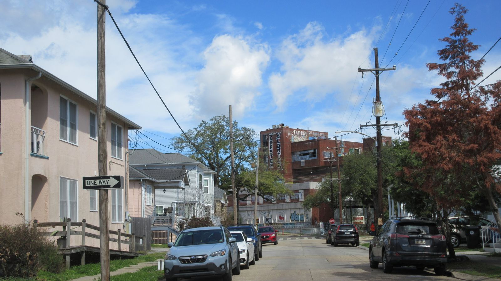
- Hero image source by Infrogmation / openverse, by-sa.
